
Australia
Bublacowie Military Museum
Military museum · South Australia
National park of Australia

Dhilba Guuranda–Innes National Park, formerly Innes National Park, is an IUCN-designated protected area in the Australian state of South Australia located on the southwest tip of Yorke Peninsula about 300 kilometres (190 mi) west of the state capital of Adelaide. It is a popular destination for camping, bushwalking, fishing, surfing and scuba diving.
Further information: Inneston, South Australia § History The Narungga people occupied the Yorke Peninsula for thousands of years. They consisted of four clans, the Kurnara of the north, the Windera of the east, the Wari of the West and the Dilpa of the south. They are the traditional owners of the land, and have strong cultural links to it, with some sites having particular spiritual significance.
European colonisation of the area began in 1846 with sheep grazing near Cape Spencer. Crops were grown on a small scale in the 19th and early 20th century. Innes National Park was named after William Innes, who discovered commercial quantities of gypsum in the early 1900s and founded the mining town of Inneston in 1913, which had a population of around 500 at its peak. Gypsum was mined until 1930 when the Great Depression made it uneconomical, and in 1970 the town and surrounding land was sold to the South Australian government, creating Innes National Park. Some gypsum mining still continues at nearby Marion Bay. [ citation needed ]
The national park was declared on 5 March 1970 under the National Parks Act 1966 as the Innes National Park, to "conserve important habitat for the western whipbird, the mallee fowl and to protect a number of heritage buildings at Inneston". Land was added to the national park in 1977, 1984 and 1993 to deal with increased recreational use.
It was renamed as the Dhilba Guuranda–Innes National Park on 14 November 2020 in recognition of a co-management agreement signed by the Government of South Australia and the Narungga people.

Some of the buildings at Inneston have been restored and are available as basic hire accommodation. [ citation needed ]
Further information: Inneston, South Australia § History The Narungga people occupied the Yorke Peninsula for thousands of years. They consisted of four clans, the Kurnara of the north, the Windera of the east, the Wari of the West and the Dilpa of the south. They are the traditional owners of the land, and have strong cultural links to it, with some sites having particular spiritual significance.
European colonisation of the area began in 1846 with sheep grazing near Cape Spencer. Crops were grown on a small scale in the 19th and early 20th century. Innes National Park was named after William Innes, who discovered commercial quantities of gypsum in the early 1900s and founded the mining town of Inneston in 1913, which had a population of around 500 at its peak. Gypsum was mined until 1930 when the Great Depression made it uneconomical, and in 1970 the town and surrounding land was sold to the South Australian government, creating Innes National Park. Some gypsum mining still continues at nearby Marion Bay. [ citation needed ]
The national park was declared on 5 March 1970 under the National Parks Act 1966 as the Innes National Park, to "conserve important habitat for the western whipbird, the mallee fowl and to protect a number of heritage buildings at Inneston". Land was added to the national park in 1977, 1984 and 1993 to deal with increased recreational use.
It was renamed as the Dhilba Guuranda–Innes National Park on 14 November 2020 in recognition of a co-management agreement signed by the Government of South Australia and the Narungga people.
Some of the buildings at Inneston have been restored and are available as basic hire accommodation. [ citation needed ]
Dhilba Guuranda–Innes National Park is located on the southern western extremity of Yorke Peninsula in South Australia about 300 kilometres (190 miles) by road from the Adelaide city centre. It is located within the locality officially known as Inneston.
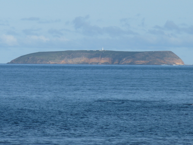
The national park occupies most of the land on the south-western tip of Yorke Peninsula south west of a line running from Willyama Bay on the south coast of the peninsula near Marion Bay to Gym Beach on the west coast of the peninsula and the following four islands immediately adjoining the coastline (from east to west): Chinamans Hat Island, Middle Island and South Island west of Pondalowie Bay, and Royston Island immediately west of Royston Head.
Within the above area, land excluded from the national park includes the following saline lakes which were associated with gypsum mining at the time of proclamation of the national park - Marion Lake, Snow Lake and Spider Lake.
As of 2014, the national park included the following "no access" areas (from east to west) - a section of coastline between Cape Spencer and Ethel Beach, South and Middle Islands at the entrance to Pondalowie Bay, Royston Island, the coastline between Royston Head and Dolphin Beach, and the coastline between Browns Beach and Gym Beach.

The coastline extending from Willyama Bay to Cape Spencer consists of a number of bays such as Cable Bay and Stenhouse Bay with some prominent headlands such as Rhino Head and a line of cliffs between Cable Bay and Stenhouse Bay. From Cape Spencer to West Cape, an unbroken line of cliffs ranging in height between 37 metres (121 feet) and 79 metres (259 feet) with some sandy beaches at their feet make up the south west coast of Yorke Peninsula. From West Cape to Pondalowie Bay, the cliff line is of a relatively lower height. From the south end of Pondalowie Bay to Gym Beach, areas of sand dunes dominate the shoreline and the land immediately adjoining it with the exception of Royston Head and the cliff line extending eastward to Dolphin Beach. The land between the national park's boundary and the road system is dominated in part by a network of saline lakes.
The national park is serviced by a road connected to the western end of the Yorke Highway which passes through Marion Bay. The road which starts at Stenhouse Bay follows the coastline as a sealed road passing Chinamans Hat Island, Cable Bay and the turn-offs to Cape Spencer, Ethel Beach, West Cape and two camping grounds at Pondalowie Bay. The road concludes as a sealed road at the turn-off to the Pondalowie Surf Break Carpark. It continues as an unsealed road, passing turn-offs to Dolphin Beach and Shell Beach, to terminate at Browns Beach in the north west of the national park. Gym Beach in the extreme north west, while being accessible via the national park's walking trail system can only reached via vehicle from the Marion Bay Road which is located to the east of the national park's boundary.
Dhilba Guuranda–Innes National Park is located on the southern western extremity of Yorke Peninsula in South Australia about 300 kilometres (190 miles) by road from the Adelaide city centre. It is located within the locality officially known as Inneston.
The national park occupies most of the land on the south-western tip of Yorke Peninsula south west of a line running from Willyama Bay on the south coast of the peninsula near Marion Bay to Gym Beach on the west coast of the peninsula and the following four islands immediately adjoining the coastline (from east to west): Chinamans Hat Island, Middle Island and South Island west of Pondalowie Bay, and Royston Island immediately west of Royston Head.
Within the above area, land excluded from the national park includes the following saline lakes which were associated with gypsum mining at the time of proclamation of the national park - Marion Lake, Snow Lake and Spider Lake.
Closest places in our Australia guide.
More places to explore in Australia.


.jpg?width=1200)


.jpg?width=1200)
.jpg?width=1200)
.jpg?width=1200)


