
Germany
Bad Hersfelder Festspiele
Music festival · Bad Hersfeld
District capital

The festival and spa town of Bad Hersfeld (German pronunciation: [baːt ˈhɛʁsfɛlt] ; Bad is "spa" in German; the Old High German name of the city was Herolfisfeld) is the district seat of the Hersfeld-Rotenburg district in northeastern Hesse, Germany, roughly 50 km southeast of Kassel. Bad Hersfeld is known countrywide above all for the Bad Hersfelder Festspiele (festival), which have taken place each year since 1951 at the monastery ruins. These themselves are said to be Europe's biggest Romanesque church ruin. In 1967, the town hosted the seventh Hessentag state festival.
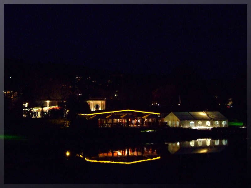
The town lies in the Hersfeld Basin formed here by the forks of the Fulda and the Haune. The inner town lies on the Fulda's left bank. Furthermore, the Geisbach and the Solz empty into the Fulda in the municipal area. In the southwest lie the Vogelsberg Mountains, in the northwest the Knüll and in the northeast the Seulingswald (ranges, the latter visible in the background of this image).
The town's lowest point, at 195 m above sea level, is to be found in the area where the Solz empties into the Fulda, whereas the highest point within town limits is the Laxberg in the Knüllgebirge, at 408 m above sea level.
The town can be said to belong both to Northern Hesse ( Nordhessen ) and Eastern Hesse ( Osthessen ).
The nearest cities are Kassel, 52 km to the north, Gießen, 79 km to the southwest, Fulda, 36 km to the south and Eisenach, 45 km to the east. Through Bad Hersfeld runs the Deutsche Fachwerkstraße ("German Timber Frame Road"), a holiday road that showcases many of Germany's timber-frame houses and buildings.
The Old Town stands on an alluvial or fluvial fan made of gravel and pebbles, which were washed up between Fulda and Geisbach. Also in the Fulda valley are found gravel and pebbles from the Holocene that are mostly of alluvial origin. There are layers of flood-deposited loess and loam of Pleistocene origin running through them. The gravel and pebbles are to a great extent made up of Middle Bunter, the most widespread stone here. In the west and east, this layer reaches from the Germanic Triassic on the Stellerskuppe (480.5 m above sea level ) and the Haukuppe (446.1 m above sea level) up to 400 m above sea level. In the east, on the Wippershainer Höhe (heights), the layer reaches up to 440 m above sea level. The Middle Bunter's lower limit is found at about 110 m above sea level.
Newer mineral layers from the Triassic are found only in sporadic deposits and discontinuous layers within town limits. This is the Röt formation, which crops up in the headwaters of the many small brooks around the town. The Lower or Middle Muschelkalk that overlies it can only be found in a narrow, west-to-east running rift stretching between Heenes and Oberrode, north of the inner town. The newest mineral layer from the Triassic – the Lower Keuper (for example the so-called Lettenkohlensandstein ) – is only preserved in the region under a lava flow, which does not show itself above ground anywhere near the town.
Owing to uplift in the Jurassic and Cretaceous, there are no mineral layers from these geological time periods. Volcanic rock from the Miocene can be found on the Haukuppe.
Mineral layers that do not reach the surface here are the Lower Bunter, running from a depth of some 90 m underneath the town (about 110 m above sea level ) down to some 390 m farther down, and, following at yet greater depths, Upper and Lower Zechstein from the Permian. From this layer come the two mineral springs in Bad Hersfeld. This layer is also used in underground mining from the 400-metre level on down on the Werra (Heringen, Philippsthal) and on the Fulda (Neuhof bei Fulda), yielding potash.
Today's main town spreads over the slopes of the Tageberg (323.5 m above sea level ), the Frauenberg (310 m), the Wehneberg (320 m) and the Wendeberg (291 m), further reaching into the valleys of the Meisebach and the Geisbach. From southwest to northeast it stretches some 4.5 km, and from northeast to southwest some 3.5 km.

The Old Town in the Fulda valley has an oval shape and an area of some 40 ha. From west to east it stretches some 960 m and from south to north some 570 m. This can still clearly be seen today, as where the town moat once led around the town there is today a ringroad that leads traffic around it.
View from the Johannesberg over Bad Hersfeld
Besides the main town – also called Bad Hersfeld – the town also has the outlying centres of Allmershausen, Asbach, Beiershausen, Eichhof, Heenes, Hohe Luft, Johannesberg, Kathus, Kohlhausen, Petersberg and Sorga.
Further subdivisions in the main town are not officially Stadtteile. The Old Town itself is divided into the Stiftsbezirk ("Monastery Zone") and the Unterstadt ("Lower Town") to the east. Between the two lies the oldest part of the Old Town. The spa is centred in a spot west of the Stiftsbezirk and is considered part of the main town. Furthermore, there are Kalkobes (a village that was amalgamated by the turn of the 20th century), Wehneberg (which arose from a lordly estate), Zellersgrund, Oberrode (an agricultural operation), Hof Hählgans (likewise an agricultural operation) and Mönches (now forsaken; a former forester's house stands here).
Clockwise from the north, these are Ludwigsau, Friedewald, Schenklengsfeld, Hauneck, Niederaula, Kirchheim and Neuenstein.

The town's sheltered location in the Fulda valley with the surrounding Hessian and Thuringian low mountain ranges leads to a relatively high average yearly temperature in Bad Hersfeld of 8.7 °C and a rather dry climate with yearly precipitation averaging only 718.1 mm. The average yearly sunshine, therefore, is quite high at 1,385.4 hours. On average over the year, Bad Hersfeld has 34 "summer days" (that is, with temperatures reaching 25 °C or higher), 86 "frost days" (with the day's lowest temperature below 0 °C) and 22 "ice days" (with the day's temperature never rising above 0 °C).
The town lies in the Hersfeld Basin formed here by the forks of the Fulda and the Haune. The inner town lies on the Fulda's left bank. Furthermore, the Geisbach and the Solz empty into the Fulda in the municipal area. In the southwest lie the Vogelsberg Mountains, in the northwest the Knüll and in the northeast the Seulingswald (ranges, the latter visible in the background of this image).
The town's lowest point, at 195 m above sea level, is to be found in the area where the Solz empties into the Fulda, whereas the highest point within town limits is the Laxberg in the Knüllgebirge, at 408 m above sea level.
The town can be said to belong both to Northern Hesse ( Nordhessen ) and Eastern Hesse ( Osthessen ).
The nearest cities are Kassel, 52 km to the north, Gießen, 79 km to the southwest, Fulda, 36 km to the south and Eisenach, 45 km to the east. Through Bad Hersfeld runs the Deutsche Fachwerkstraße ("German Timber Frame Road"), a holiday road that showcases many of Germany's timber-frame houses and buildings.
Closest places in our Germany guide.
More places to explore in Germany.


