Germany
Audi-Sportpark
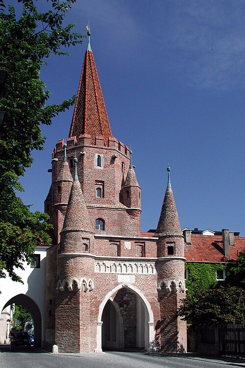
Association football venue · Ingolstadt
Oppidum

The Oppidum of Manching (German: Oppidum von Manching) was a large Celtic proto-urban or city-like settlement at modern-day Manching, near Ingolstadt in Bavaria, Germany. The Iron Age town (or oppidum) was founded in the 3rd century BC and existed until c. 50–30 BC. It reached its largest extent during the late La Tène period (late 2nd century BC), when it was 380 hectares in size. At that time, 5,000–10,000 people lived within its 7.2-km walls. Thus, the Manching oppidum was one of the largest settlements north of the Alps. The ancient name of the site is unknown, but it is assumed that it was the central site of the Celtic Vindelici tribe.
The enormous circular fortification around the site survived the demise of the settlement as a visible landscape feature. It had already been noted by the Romans (see below); for centuries it remained an important landmark e.g. for the boundaries of parishes or bishoprics. The schoolteacher J.A. Buchner (1776–1854) wrote an initial description of Manching in 1831, under the erroneous assumption of having found the Roman site of Vallatum. First excavations took place in 1892–93 under Joseph Fink (1859–1929). In 1903, Paul Reinecke recognised the site as a Celtic oppidum.
In 1936–38, during the Nazi remilitarisation of Germany, the Luftwaffe constructed an airfield at Manching. This led to the destruction of large portions of the site, without providing the opportunity for systematic archaeological research. Only very few finds were recovered from the construction site. In 1938, the archaeologist Karl-Heinz Wagner started an excavation of the northeast part of the enclosure. Within the visible earthen bank, he discovered the remains of a wall, which he described as a murus gallicus according to Julius Caesar 's description of such structures. Due to the presence of the airfield, Manching was the target of multiple bombing raids during World War II, causing further destruction of archaeological evidence.
Since 1955, the Römisch-Germanische Kommission [ de ] (Romano-German Commission) of the German Archaeological Institute and the Bavarian State Archaeological Service have conducted extensive excavations at the site:
By 1987, c. 12 hectares of the settlement had been examined. Since 1996, a series of further rescue excavations ("Altenfeld" and the EADS area) have been conducted by Susanne Sievers [ de ], increasing the excavated area to 26 hectares by 2002. As a result, Manching is the most substantially explored oppidum in Central Europe. The increasing degree of exploration has, however, caused progressive destruction of the site, since much of the new excavations take place to retrieve information before areas are built upon.
Since 2006, finds from the oppidum have beem on display in the Kelten Römer Museum Manching [ de ; fr ; it ] (Celts and Romans Museum Manching), a branch of the Bavarian State Archaeological Collection.
Unlike other contemporary Celtic oppida, Manching was not located on a hilltop but in a riverine plain. The site was placed in a strategic position at the crossing of two ancient trade routes, one running north–south, the other west–east. It was also near the confluence of the rivers Paar and Danube, giving access to navigation of the latter, therey further increasing the potential for long-distance trade. A distributary of the Danube, northeast of the settlement, had been transformed into a harbour. Manching was probably the most important centre of trade and economy in the late La Tène period. It also had access to rich deposits of iron ore and gold in the immediate vicinity.
The settlement was designed and built according to a systematic plan. Oriented to the cardinal directions, the area was divided into individual parcels, each with a farmyard-like fence. The interpretation of these rectangular complexes remains controversial. They could represent autonomous farmsteads, reminiscent of Hallstatt period " Manors " ( Herrenhöfe ). Such an essentially rural type of settlement is not suggested by recent research. [ citation needed ] It seems more likely that the rectangular parcels represent areas of specialised function, including aspects like agriculture, craft production and religion. The excavations at "Altenfeld" in particular support this conclusion, since they revealed a veritable artisan's quarter. The central part of the settlement contained a cult complex (see below).
Along the east–west road, linking the known east gate with an assumed west one, there were small huts. Finds suggest that they were stalls for selling trade goods. There was probably a similar road leading northwards from the south gate.
Settlement density within the oppidum was not evenly distributed. Only the central area, right between the east gate and the assumed western one, was placed on relatively dry alluvial soils and most densely settled. Occupation was thinner toward the edges; a 500-m strip inside the wall shows no indication of settlement at all. This area may have been used for cultivation and grazing.
The settlement consisted of single-storeyed post houses with one or more rooms and an area of 40–100 m 2. Some of the buildings were probably half-timbered. The picture is completed by long houses, cellars, storage structures on stilts, storage pits, workshops, and wells. Many ground plans have measurements that can be identified as multiples of half a Celtic foot (15.45 cm). Franz Schubert even found a rod on which bronze rings mark that length, suggesting that it is a measuring rod.
The first enclosure wall was erected c. 150 BC in the murus gallicus technique. It has been calculated that more than 8 tons of nails must have been used in the construction of the 7.2 km of fortification. The exact reasons for its construction are unknown, but apart from a potential threat to the settlement, aspects of prestige may also have played an important role. This is especially suggested by the monumental gate complexes. On the inside, the wall was reinforced by an earthen ramp of 9 m width. The second wall was erected c. 104 BC as a Pfostenschlitzmauer incorporating the old wall within its body. The Pfostenschlitzmauer technique was also used for a third phase. Before excavation, part of the walls were still visible as a 4-m-high earthen rampart. Manching appears to be the only known oppidum where murus gallicus (a mostly western Celtic phenomenon) and Pfostenschlitzmauer (common further east) occur in a single site.
The river Igelsbach, which approaches the site from the southwest, was channeled so as to run into the Paar along the wall. Previously, it had run right through the settlement area. Therefore, the southwest part of the walls also possessed an external moat.
The east gate has been especially well studied. Its remains can be visited, as can a reconstruction (further south). It was a Zangentor, i.e., the wall protruded on both sides in front of the actual entrance, thus making it more defensible, as well as more imposing. The gate's superstructure is unknown. This gate was destroyed by fire in 80 BC and its ruins were never cleared, suggesting that the road which it had served was out of use by that time.
A variety of evidence suggests that some agricultural activity took place inside the settlement. Residents may have worked fields at the edge of the oppidum in particular. During its heyday, however, the oppidum must also have depended on agricultural produce from surrounding areas. The main cultivated food plants were barley and spelt. Proso millet, einkorn, emmer, avena, wheat and rye were also grown. Lentils, vicia faba, poppy, hazelnut and various fruits were also consumed.
An enormous amount of animal bones indicates intense husbandry; perhaps Manching also served as a supra-regional livestock mart.
The position of the site near several streams and rivers suggests that fish was part of the residents' diet. In recent years, the intensive study of pit fills has proven this true. Even traces of the typical Mediterranean fish sauce garum have been recovered.
Manching was the site of an extensive iron industry, which mainly produced goods for local use. Iron ore was extracted in the region. Products included a variety of specialised tools, clearly indicating a lively craft tradition. Manching was a centre of production for glass beads and bracelets, most of them of blue glass. There was also a developed production of pottery, jewellery and textiles.
Finds like Baltic amber and Mediterranean wine amphorae show that Manching was part of trade networks spanning all of Europe. Further evidence is provided by luxury tableware ( campana ), bronze vessels and imported jewellery.
Trade was facilitated by the fact that Manching had its own mint. A local system of coinage, including small silver coins ( quinarii ) and impure bronze ones, served mainly for internal trade. External trade relied on coins of gold and, from the early 1st century BC onward, silver. Like much Celtic coinage, the gold coins minted at Manching are distinctively concave, even cup-shaped. In German, such coins are traditionally known as Regenbogenschüsselchen or rainbow cups, a term derived from the belief that they are connected with the treasure to be found at the end of a rainbow. Counterfeit coins, such as bronze ones with a thin gold covering, have also been found. Fine weighing scales were used to monitor the authenticity and value of coins.
Closest places in our Germany guide.
More places to explore in Germany.