Spain
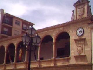
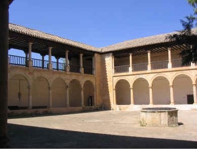
Church of Santa Catalina
Church building · El Bonillo
Ancient city
Laminium was an oppidum (fortified city), the southernmost of the Carpetan tribe and head of the Ager Laminitanus. Pliny the Elder and Ptolemy make references to it on several occasions. The Roman Laminium acquired the status of Flavian municipality (municipio flavio), with the privileges that it entailed, like other cities such as Complutum, Toletum or Consaburum, which leads us to believe that it would have a certain importance in terms of civil and religious works. It was also part of the main Roman road network, as an important communications hub. In the so-called Itinerary of Antoninus it is located on the roads:
XXIX, Caesaraugusta-Augusta Emerita. XXX, Laminio-Toletum. XXXI, Laminio-Libisosa. Currently the most widespread theory is that Laminium is located in the current urban area of Alhambra. However, since ancient times there have been other hypotheses about its location, so there is a certain legend in La Mancha of a "lost city" around it that has fueled interest in its search and perhaps has magnified its real importance. The latest archaeological excavations in Alhambra reveal the existence of a large oppidum.
Pliny refers, among the most important communities of the conventus carthaginensis, to the consaburenses ( Consabura ), the egelestani ( Egelesta ), the laminitani (Laminium), the segobrigenses ( Segóbriga ), who form the "head" of Celtiberia and the toletani ( Toletum ), who form the "head" of Carpetania. Likewise, he affirms that the river Anas ( Guadiana ) rises in the Laminitanian countryside.
In northwest direction, and if we consider the usual equivalence of 1 Roman mile = 1480 meters, the Itinerary of Antoninus places Laminio at about 11 km (7 Roman miles) from Caput Fluminis Anae (on the Libisosa -Laminio road) and this mansion at 21 km (14 Roman miles) from Libisosa (today's Lezuza ). The name of this mansion is in accusative, which may suggest that it would be a point on the road from where a road to the source of the Guadiana River would start and not necessarily a town located at the headwaters of the Anas River.
Due to its proximity to Laminio and to a safe location (Lezuza), the location of this place has been one of the main objectives of the researchers as a previous step to the discovery of the city. But it has also turned out to be one of the most important sources of controversy, since to this day people are still trying to determine where exactly the river rises. In fact, the theories that locate Laminio in Alhambra and Daimiel take into account the proximity to the place where one of the sources of the Guadiana ( Ojos del Guadiana ) is located, but they ignore the excessive distance (more than 70 km) with Lezuza, alleging medieval translation errors. Such a considerable distance is not a trivial matter and seems difficult to assume for a people as pragmatic as the Romans, since it is almost double what it is considered that one could travel in that time in one day.
Based on works from the Muslim and medieval periods, other authors determine that, as for the Romans, the sources of the Anas River would have been located in the Córcoles - Sotuélamos system or in the Lagunas de Ruidera ( Alto Guadiana ). Paleogeography and archeology seem to support those who maintain these theses, since they affirm that the area, in ancient times, provided much more water to the Anas than it does today. It is even claimed that the Záncara constituted for millennia the true upper course of the river.
A Caput Fluminis Anae and a Laminio in the surroundings of the Córcoles would solve the problem of the distances for the Routes XXIX and XXXI of the Itinerary of Antoninus. On the other hand, it would create the problem of fitting the distances of Via XXX (the one to Toletum), which is the shortest and has two perfectly located mansions. To solve this problem, Gonzalo Arias suggested several possibilities:
- That the "Limini" of Via XXX is a different mansion from the "Laminio" of Via XXXI.
- That the "Limini" of Via XXX refers to the limit ( Lamine in Latin) of the municipality of Laminio (not to the urban enclave) and in reality this road runs between Toledo and that point (Junction theory).
- That intermediate mansions are missing in the original text, possibly from very early times and the different later copyists have amended and squared the distances. Pliny also suggests that the Laminitanian sharpening stones were the best of their kind in the whole Empire.
refers, among the most important communities of the conventus carthaginensis, to the consaburenses ( Consabura ), the egelestani ( Egelesta ), the laminitani (Laminium), the segobrigenses ( Segóbriga ), who form the "head" of Celtiberia and the toletani ( Toletum ), who form the "head" of Carpetania. Likewise, he affirms that the river Anas ( Guadiana ) rises in the Laminitanian countryside.
In northwest direction, and if we consider the usual equivalence of 1 Roman mile = 1480 meters, the Itinerary of Antoninus places Laminio at about 11 km (7 Roman miles) from Caput Fluminis Anae (on the Libisosa -Laminio road) and this mansion at 21 km (14 Roman miles) from Libisosa (today's Lezuza ). The name of this mansion is in accusative, which may suggest that it would be a point on the road from where a road to the source of the Guadiana River would start and not necessarily a town located at the headwaters of the Anas River.
Due to its proximity to Laminio and to a safe location (Lezuza), the location of this place has been one of the main objectives of the researchers as a previous step to the discovery of the city. But it has also turned out to be one of the most important sources of controversy, since to this day people are still trying to determine where exactly the river rises. In fact, the theories that locate Laminio in Alhambra and Daimiel take into account the proximity to the place where one of the sources of the Guadiana ( Ojos del Guadiana ) is located, but they ignore the excessive distance (more than 70 km) with Lezuza, alleging medieval translation errors. Such a considerable distance is not a trivial matter and seems difficult to assume for a people as pragmatic as the Romans, since it is almost double what it is considered that one could travel in that time in one day.
Based on works from the Muslim and medieval periods, other authors determine that, as for the Romans, the sources of the Anas River would have been located in the Córcoles - Sotuélamos system or in the Lagunas de Ruidera ( Alto Guadiana ). Paleogeography and archeology seem to support those who maintain these theses, since they affirm that the area, in ancient times, provided much more water to the Anas than it does today. It is even claimed that the Záncara constituted for millennia the true upper course of the river.
A Caput Fluminis Anae and a Laminio in the surroundings of the Córcoles would solve the problem of the distances for the Routes XXIX and XXXI of the Itinerary of Antoninus. On the other hand, it would create the problem of fitting the distances of Via XXX (the one to Toletum), which is the shortest and has two perfectly located mansions. To solve this problem, Gonzalo Arias suggested several possibilities:
- That the "Limini" of Via XXX is a different mansion from the "Laminio" of Via XXXI.
- That the "Limini" of Via XXX refers to the limit ( Lamine in Latin) of the municipality of Laminio (not to the urban enclave) and in reality this road runs between Toledo and that point (Junction theory).
- That intermediate mansions are missing in the original text, possibly from very early times and the different later copyists have amended and squared the distances. Pliny also suggests that the Laminitanian sharpening stones were the best of their kind in the whole Empire.
Throughout history, the city of Laminium has been located in many different places within a very large area that, although entirely in the natural region of La Mancha, covers parts of the provinces of Ciudad Real and Albacete. Nowadays, universities and academies reduce Laminium to the current municipality of Alhambra. However, since ancient times there has been a tradition of local historians who have tried to reduce it to other points. Thus, a site has been proposed in the vicinity of Daimiel or in another site located between the municipalities of El Bonillo and Villarrobledo, in the province of Albacete.
Rodríguez Morales locates Laminio in the city of Daimiel. He argues in favor of its proximity to one of the places considered to be the source of the Guadiana River and its location near the Tablas de Daimiel, suggesting that, etymologically, Laminio would mean something similar to 'city of the lakes' or 'the marshes'. Likewise, it is maintained that the current name of Daimiel is nothing more than a phonetic corruption of Laminio.
Closest places in our Spain guide.
More places to explore in Spain.